Recently we wrote a blog listing some of our favorite quick hikes off of the Gunflint Trail. These were hikes that take between 1-3 hours with a couple of them even being under an hour specifically for people with limited time on their hands, children, or are new to hiking. We will be expanding on our list of hiking options off of the Gunflint Trail with full day length hikes that will take between 4-8 hours to complete. The hikes listed below are for moderately experienced to very experienced hikers who want to spend the day on the trail getting to places most people never do. As with any popular place the farther you walk or paddle from a parking lot, the fewer people you are going to encounter. Most of these hikes utilize the Border Route Trail which does not offer any easily conceivable loops and will leave you in a different place than you started, so besides the overall challenge of the trail and its length the logistics of dropping vehicles or setting up a shuttle for a pick up or drop off also needs to be considered. Preparation for these hikes is critical as they offer very few opportunities to access lakes for water and very few exit points to cut the hike short if you get in over your head. Once you start in on these trails you better be prepared to finish them or turn around and as such you should always inform somebody who is not hiking with you what your itinerary for the day is. With all of that being said if you are up for a challenge that will bring you to some of the most untouched trails and stunning vistas on the Gunflint Trail and maybe even in the entire BWCA, then these hikes are for you.
Bridal Veil Falls via the Crab Lake Trail and Border Route Trail
Distance: 6+ Miles Round-Trip
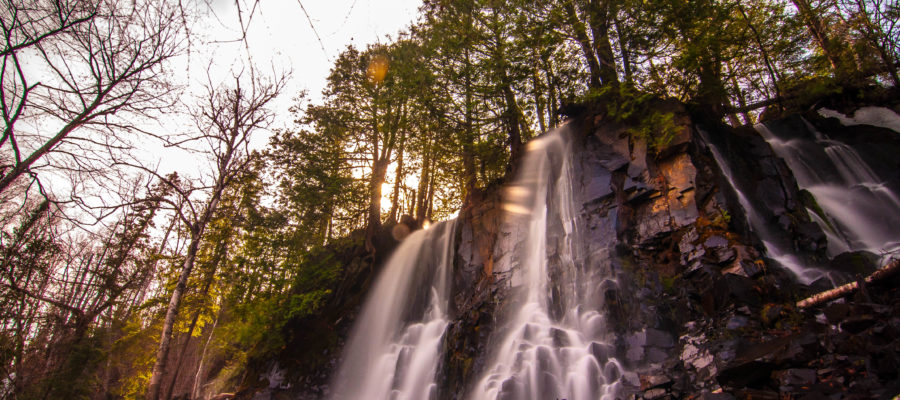
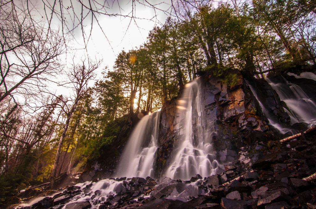
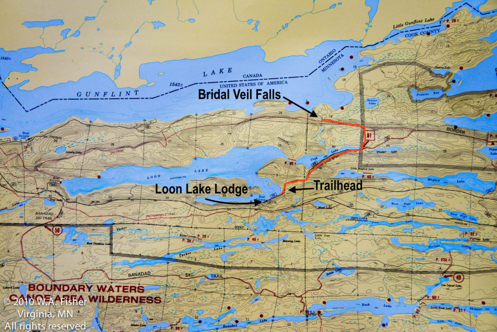
This is the easiest hike on the list, but it brings you to one of the hidden gems of the Gunflint Trail. For whatever reason Bridal Veil Falls gets much less attention than Rose and Johnson Falls, even though it is arguably the most beautiful and accessible waterfalls on the Gunflint Trail. You can access these falls from the water off of Gunflint Lake with a motorboat or canoe which may be the easiest way, but this roughly 6 miles out and back trail is the next best option. It starts at the Crab Lake Spur Trailhead which is located about a mile down N Loon Lake Road off of the Gunflint Trail. On your way up the Gunflint keep an eye out for a sign for Iron Lake Campground on the left and which is the last road before looking for a sign for Loon Lake Lodge on the right, this is Loon Lake Rd. Follow the road down to the lake and through Loon Lake Lodge’s Resort until the road ends at the trail head and BWCA permit kiosk. From here the trail is nice and flat and follows the edge of Crab Lake for about a mile until the lake ends and the trail T’s left to the north. Keep an eye out for this turn, otherwise you will add considerable distance to your hike, as this cutoff trail hooks up with the Border Route Trail where upon meeting it at another T you will want to take another left, to the west. This section of the BRT was largely affected by the Ham Lake Fire in 2007 and runs along a ridge high above Gunflint Lake, this combination of lighter growth smaller trees and elevation makes for nice consistent views to the north into Canada. From the intersection of the cutoff trail and BRT to the falls is a little under a mile, and the falls can be missed if you don’t keep a lookout for a small wooden bridge going over some moving water; this moving water is what creates parts of the falls. If you cross the bridge you have gone too far, cut down before the bridge and follow the rapids until you can find a nice place to cross to the other side where the water drops over a sheer cliff in magnificent fashion. Keep in mind these falls can be seasonal on a dry year, the best time to head out there is in the spring.
Mountain Lake Portage Back to Clearwater Lodge via the Border Route Trail and Daniels Spur Trail
Distance: 7+ Miles
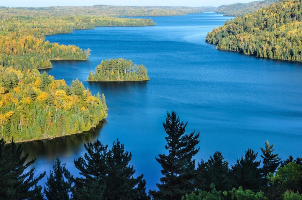
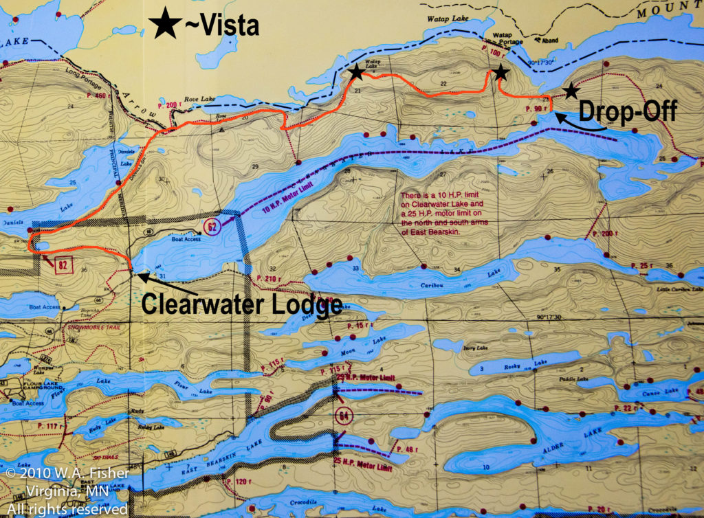
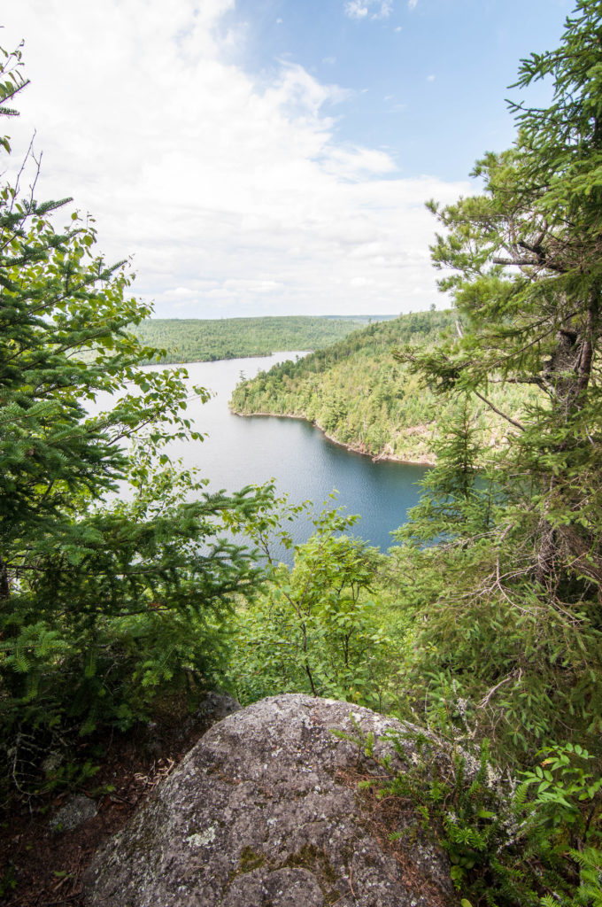
The vistas of the Border Route Trail are what makes it one of the most spectacular trails in the state. The challenge is that the trail is a 40 mile straight shot through some of the most rugged terrain in the BWCA with access points that make it almost impossible to create a loop where you can end back where you started without backtracking. One of the solutions to this problem is getting dropped off at some point and hiking back to your vehicle or a lodge. This section of the Border Route Trail can be accessed via the Clearwater to Mountain Lake Portage, which itself can be accessed by being dropped off with a boat on Clearwater Lake. Halfway across the portage from Clearwater to Mountain the BRT intersects and you will want to take a hard left to the west. From here you will slowly climb up to one of the best views in the area over Mountain Lake and beyond. The trail remains atop a nice pine filled ridge for almost another two miles before reaching another lofty vista overlooking Rove and Watap Lakes. After this vista the trail slowly descends all the way down to the shores of Rove until it hooks into the “Long Portage”. Pay attention for when this portages intersects with the Daniels Spur trail where there is a sign pointing you to the left towards Daniels Lake. The spur trail walks right along Daniels Lake and used to be an old railroad grade so it is incredibly flat and offers easy footing so you can keep your eyes out on the lake for wildlife. The last mile of the trail before you are dumped out onto Clearwater Road does have some wet spots, but when you are that close to finishing up a 7 mile hike you will hardly notice.
Caribou Rock Trail to Border Route Trail to Daniels Spur Trail to Clearwater Lodge or Vice-Versa
Distance: 10+ Miles
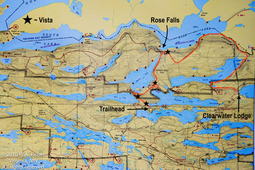
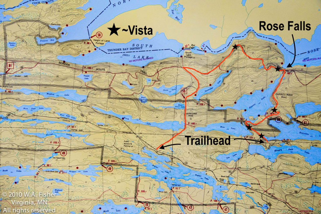
We’re into some serious hiking now with this combination of trails. It is hard to say which way this trail should be hiked, and it probably comes down to how you can arrange a pick up or drop off. If you are staying with us at Clearwater the best way to tackle this hike would be by having us shuttle you to the Caribou Rock Trailhead where you would then hike back to the lodge. If you have other means of arranging a shuttle it can be hiked in the opposite direction ending at the Caribou Rock Trailhead, but we will be describing it from west to east. The trailhead for the Caribou Rock Trail is located about 2 miles down Hungry Jack Road, which is about 28 miles up the Gunflint Trail out of Grand Marais on the right hand side of the road just before Trail Center Lodge and Restaurant. Parking for the trail is right on the road itself which is very hard to miss, but if you get to Hungry Jack Lodge you have gone too far. The three-mile section of the Caribou Rock Trail is by far the most challenging stretch of this hike with multiple significant climbs and drops before reaching Rose Falls. There are multiple vistas throughout this hike with the best one being just east of Rose Falls on the Border Route Trail with seemingly endless views over Rose Lake into Canada. From Rose Falls to the east you will climb significantly right away and then slowly descend all of the way down to the shores of Rose Lake before running into the “Long Portage”. This portage shares its name with the BRT and used to be a rail road grade used for logging making it nice and flat and easy to follow. It does follow a creek that connects Rove with Rose and depending on the beaver activity has been known to flood, check with locals for the most up to date conditions. After a gradual climb up from Rose you will see the portage take a sharp left towards Rove, make sure you keep heading straight towards Daniels Lake here following the spur trail. After a flat three miles along Daniels Lake and through the woods you will come out onto Clearwater Road where you will want to take a right and short walk to reach Clearwater Lodge.
South Lake Trail to Border Route Trail to Caribou Rock Rock Trail or Vice Versa
Distance: 11+ Miles
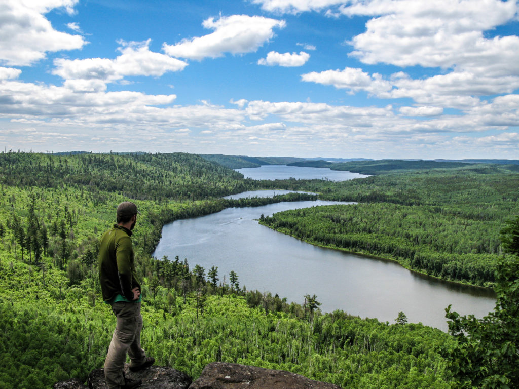
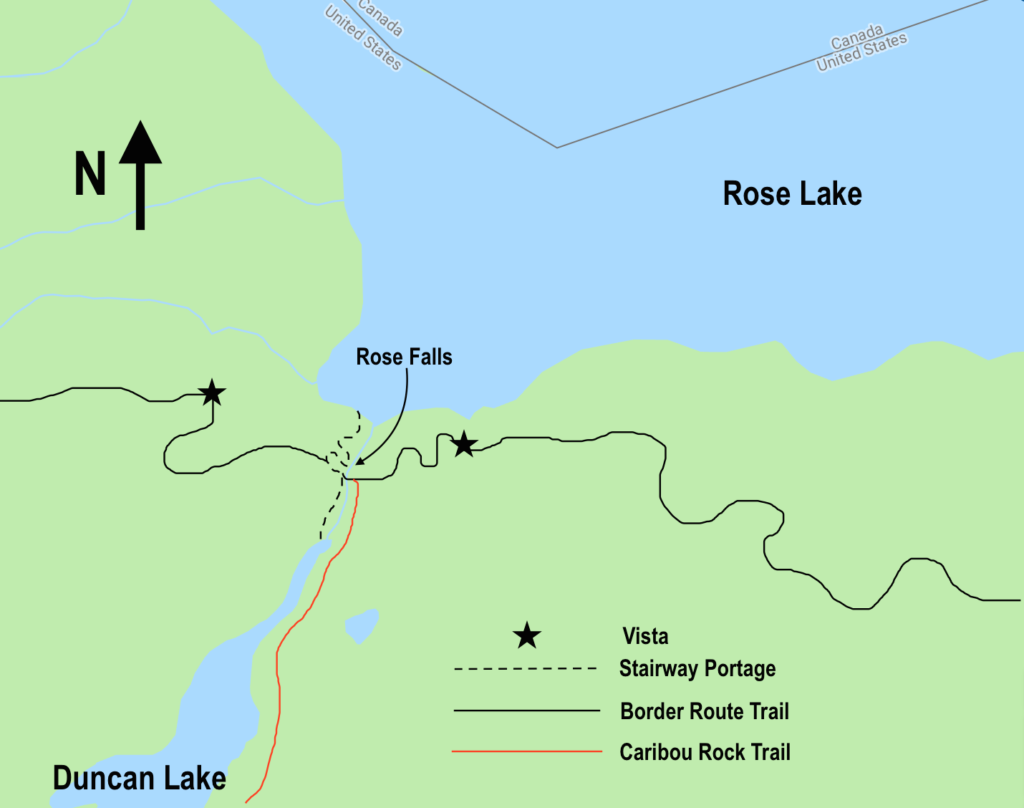
While this is the longest hike on the list it offers access to our personal favorite vista in the entire Boundary Waters Canoe Area Wilderness if not the state. Unfortunately, this incredible vista is the same distance from either of the closest trailheads making it one of the least accessible vistas on the Border Route Trail. It seems to be a little easier to hike from west to east starting at the South Lake Trail, though it is probably closer to a toss up, either way we will start by describing it from the west at the South Lake Trailhead. The South Lake Trailhead is right on the Gunflint Trail about 30 miles out of Grand Marais and does not offer any legitimate parking in the immediate vicinity, we recommend either getting shuttled to the trailhead and dropped off or parking at Rockwood Lodge, with their permission. The South Lake Trail will gradually drop from the Gunflint Trail for a little over two miles before reaching the campsite on Partridge Lake, along the way passing Birch and East Otter Lakes. From this campsite the trail is flat and wet for another mile or so before intersecting with the Border Route Trail where you will want to turn right to the east and start the gradual and sometimes arduous climb up to the reason you’re here to begin with. The climb from the intersection of the South Lake Trail and BRT starts out gradually enough but eventually reaches a pitch that will have you on all fours desperately reaching for the next rock while gasping for air, praying for an end that is not in sight, and cursing whoever convinced you this vista was ever worth it in the first place. Alright, that may be a bit of an exaggeration but plan on taking a break at the top to compose yourself, catch your breath and take in the incredible views to the west overlooking Rose, South and North Lakes. From the vista you’re about halfway done and the trail slowly meanders atop the ridges above the western arm of Rose Lake before dropping to another nice vista overlooking Rose and Arrow Lakes. Shortly after this vista you will hook in with the stairway portage and in order to access the Caribou Rock Trail you will need to look for a little bridge that crosses the creek that creates Rose Falls. On the other side of this bridge look for a trail that heads to the right, this is the Caribou Rock Trail and after another three miles of climbing and dropping you will find yourself at the trailhead on Hungry Jack Road.
Considering the somewhat confusing three-way intersection between the Stairway Portage, Border Route Trail, and Caribou Rock Trail we have provided an additional close up map of the area to clear up any confusion.

Leave a Reply
Your email is safe with us.
You must be logged in to post a comment.